Characteristics of the Vichada River Basin
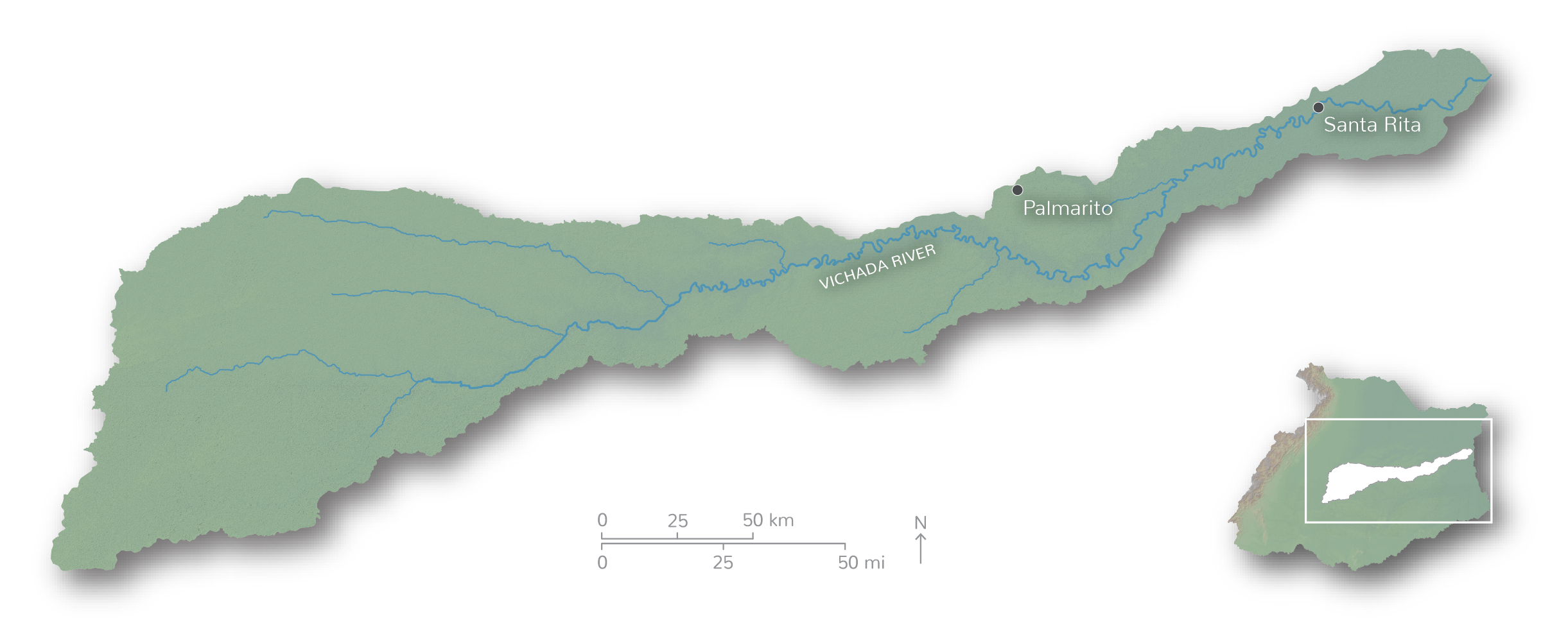
The clear waters of the Vichada River originate in the Altillanura and travel 1,055 km through the Meta and Vichada Departments before flowing into the Orinoco River, near the Tuparro River. The relatively large and linear basin (2,621,190 ha) includes seasonal savannas, tropical rain forest, gallery forest, and flooded savannas linked to the main channel of the river. The main threats are expansion of agriculture, intensive oil and gas exploitation in the upper part of the basin, illegal farming, and land ownership conflicts.
Moderately good health for the Vichada, despite pressure in the headwaters

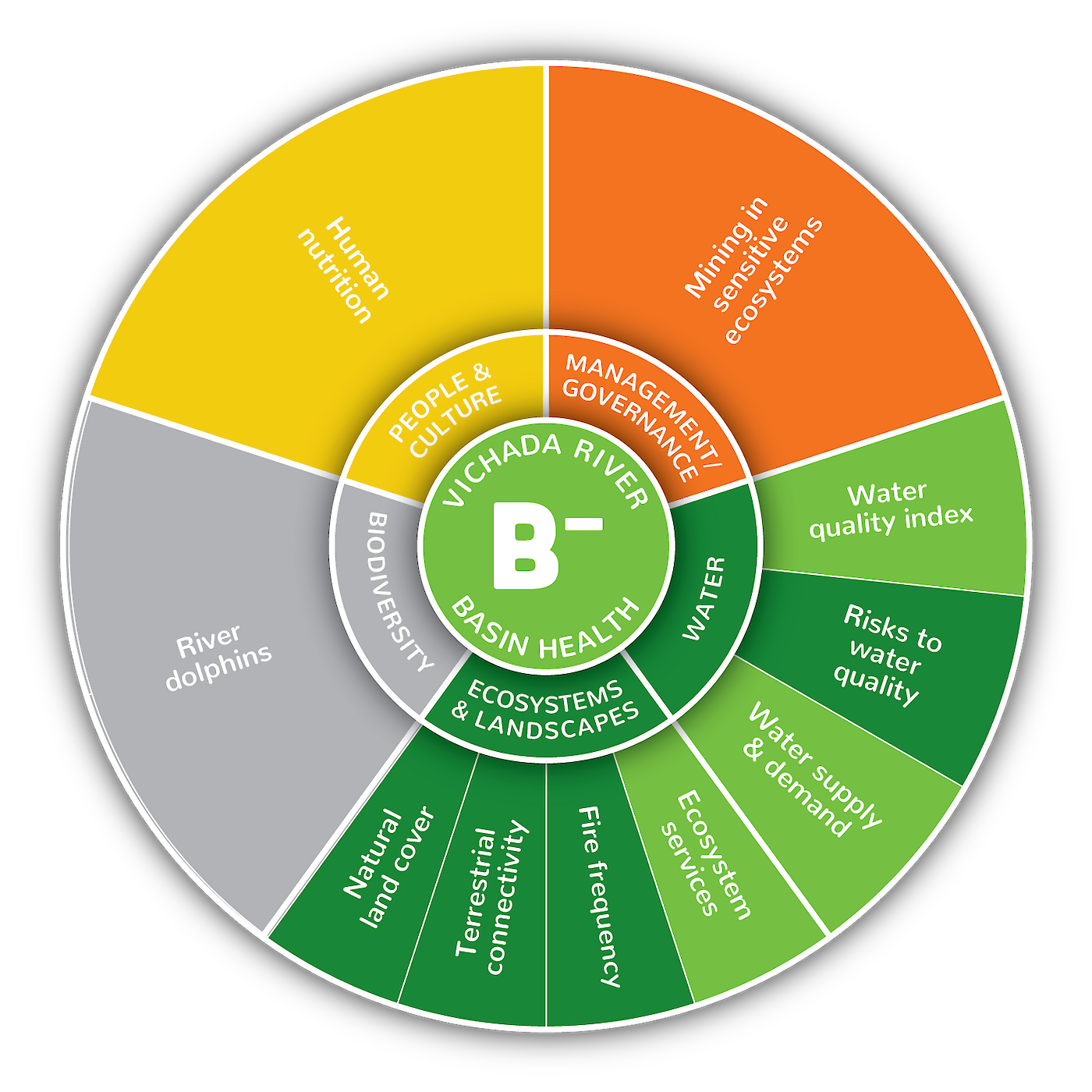
The Vichada River Basin received an overall B- grade (61%). Of the nine indicators assessed, all were excellent (>80%) or good (60-80%) except for human nutrition (50%) and mining in sensitive ecosystems (25%), the latter reflecting the level of mineral and hydrocarbon exploitation in the western headwater portion of the Vichada River Basin, mainly in the Puerto Gaitan municipality. The contradiction between the excellent indicator scores for the current state of ecosystems and landscapes and the very low scores for indicators of mining in sensitive ecosystem suggests that either exploitation activities are not yet impacting the river basin or that monitoring is not capturing these impacts, making this an issue that will be useful to track in future report cards. No biodiversity data was available for this version of the report card, but it is anticipated that new information on river dolphin abundance will become available for future report cards.

