Characteristics of the Meta River Basin
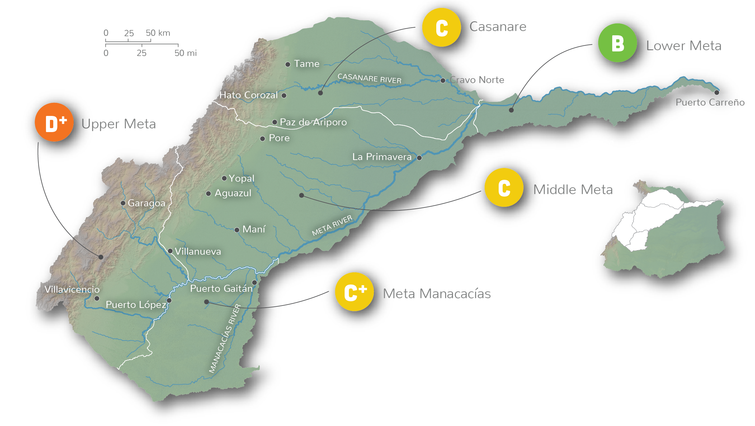
The Meta River originates in the Andes and is the largest sub-basin of the Colombian portion of the Orinoco River (1,250 km long and 10,673,344 ha in area). Due to its size and varied land-uses, the Meta sub-basin has been split into five reporting regions for this assessment, the Upper Meta, Meta Manacacías, Middle Meta, Casanare and Lower Meta. The basin includes many ecosystem types such as the Páramo, Andean forests, flooded savannas, and flooded forests. Main threats to the sub-basin are from livestock expansion, pollution by urban areas and by the oil and gas industry, natural habitat loss by mining and agro-industry, and growing conflict between different sectors for water supply.
Poor health of Andean headwaters puts eastern plains at risk

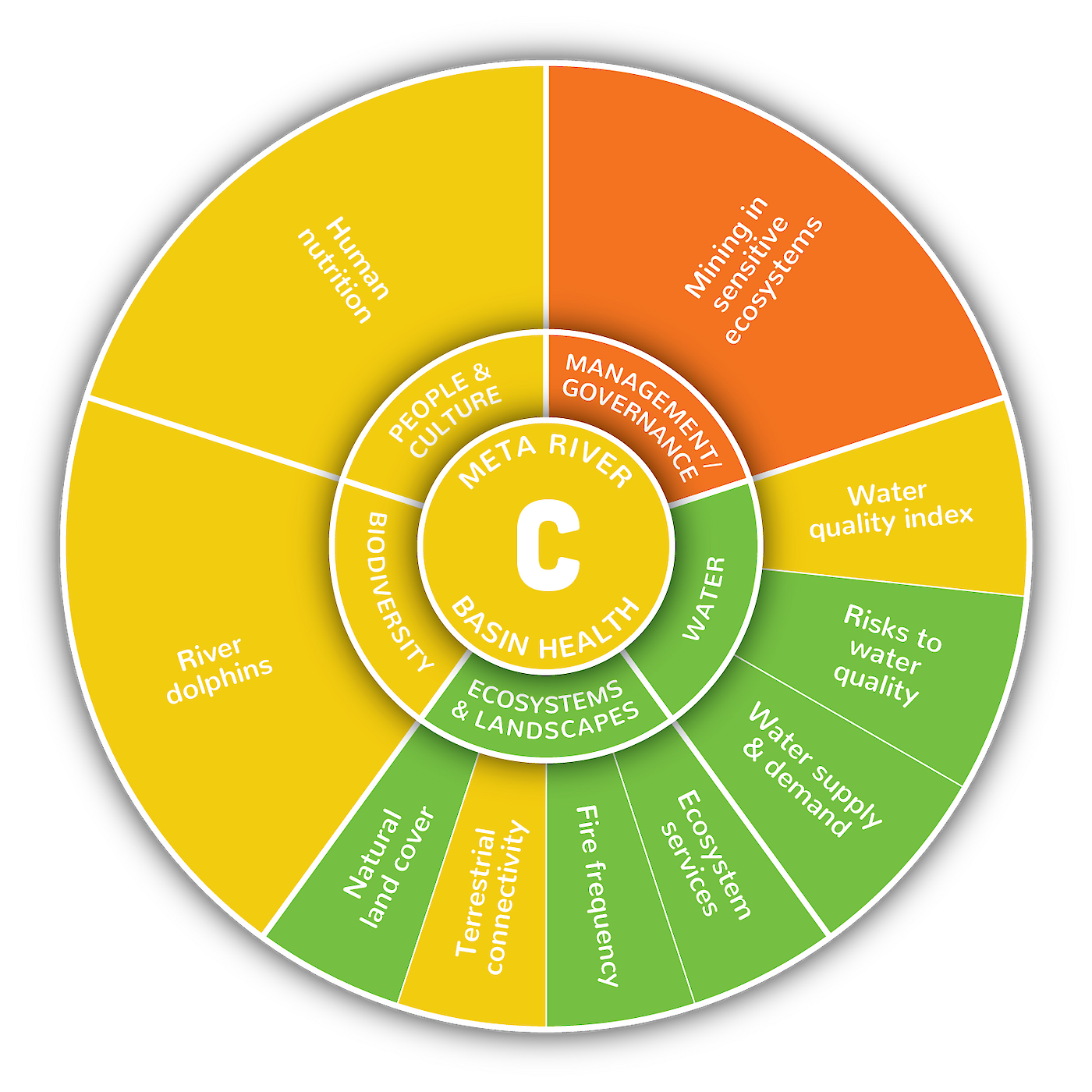
The Meta River Basin received an overall area-weighted average grade of C (48%), with the Upper Meta receiving a D+ (37%), Meta Manacacías a C+ (56%), Middle Meta a C (49%), Casanare a C (47%) and Lower Meta receiving a B (71%). This represents a strong transition in the health of the basin with poorer conditions in the western Andean portion and better conditions towards the eastern plains, which is still unfortunately impacted by poor upstream conditions.
Overall basin scores ranged from as low as 21% for mining in sensitive ecosystems, to 76% for risks to water quality. The overall scores for the entire sub-basin, however, do not reflect the full story about the conditions in specific areas. Poor scores in different parts of the basin result from region-specific resource exploitation patterns. For example, failing scores in the Upper Meta for terrestrial connectivity are due to historical fragmentation of the landscape.
The Casanare had failing scores for mining in sensitive ecosystems, due to mining in wetlands and riparian forests located in the Tame, Paz de Ariporo, and Hato Corozal municipalities. The Casanare received the second-worst score for water quality (37%) in the entire Orinoco Basin, likely as a result of oil and gas pressures. The Meta Manacacías basin had poor scores for fire frequency, likely due to the expansion of agro-industries. The Middle Meta had failing scores for mining in sensitive ecosystems, and low scores for the water quality index (46%) and terrestrial connectivity (46%), due to growing urban areas and new infrastructure.

