Characteristics of the Guaviare River Basin
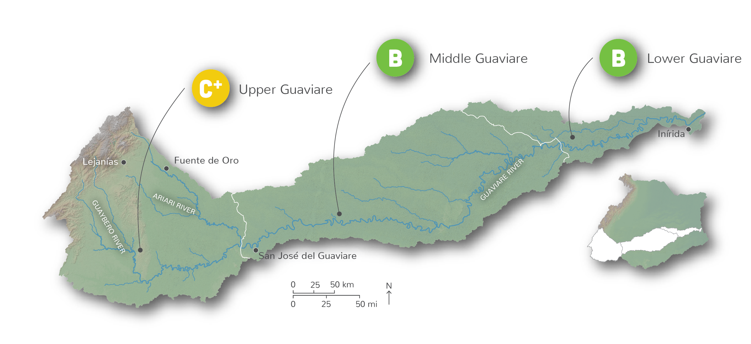
The Guaviare River originates in the Andes is the longest tributary in the Colombian portion of the Orinoco River (1,652 km). Due to its length and varied land uses, the Guaviare sub-basin has been split into three reporting regions for this assessment, the Upper, Middle, and Lower Guaviare. The basin includes a variety of ecosystems, with flooded savanna as the dominant type, followed by seasonal savannas, humid paramos, and Andean rainforest. Main threats to the sub-basin include deforestation for expanding agriculture; exploitation of natural resources from hunting, fishing, and illegal farming; and pollution from mining.
A spectacular basin in transition

The Guaviare River Basin received an overall area-weighted average grade of B- (64%), with the Upper Guaviare receiving a C+ (56%), and the Middle and Lower Guaviare receiving a B (70% and 69%, respectively). There was a mix of moderate, good, and excellent results for the ten indicators assessed. Overall basin scores ranged from as low as 45% for water quality and human nutrition, to 95% for water supply and demand. Overall the sub-basin had excellent scores for risk to water quality (90%), water supply and demand (95%), natural land cover (85%), stable forest area (87%), and ecosystem services (82%). However the overall score for the entire sub-basin, is not representative of each of the three reporting regions, with very poor scores in the Upper Guaviare for terrestrial connectivity (23%) and water quality (35%). Mining for construction materials and limestone in and around the Ariari River, near the Macarena Range, is likely contributing to the poor water quality observed in the Upper Guaviare as well as the lowest score for stable forest area (76%) in the entire Orinoco River Basin.

