The Orinoco River: water, biodiversity, & challenges
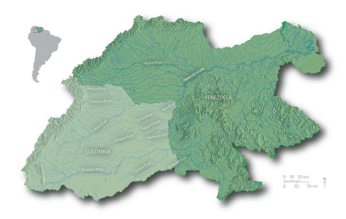
 The mighty Orinoco River, one of the longest rivers in South America (2,150 km), is ranked third worldwide in flow and fifth in sediment transport. The basin, which covers 981,446 km2 and is shared by Colombia (35%) and Venezuela (65%), is one of the most biologically, hydrologically, and culturally rich areas in the world. Water and nutrients that originate in the upstream ecosystems of the Andes and the Guyana Shield maintain and regulate hydrological functions and ecological processes downstream in the Llanos floodplains. In the Llanos, the flow of sediments and water slows and along with seasonal rains, replenishes rivers and wetlands that serve as important habitats. Diverse species such as birds, mammals (jaguar, river dolphins, and otters), reptiles (the endangered Orinoco crocodile), and fish rely on these habitats as well as the important tropical forest area of the Amazon–Orinoco transition zone.
Abundant water in the Orinoco River Basin supports the needs of people, agriculture, energy and industry (oil and gas) that are vital for Colombia's social and economic development. But the basin faces increasing pressures from the expansion of mining (942 concessions for 2014), oil and gas (8 million ha under exploration), agro-industry (320,829 ha), and infrastructure, which if not adequately planned and implemented can disrupt the hydrology and ecosystem services of the region. Additionally, the Orinoco Basin’s seasonal rainfall patterns will potentially face further extremes and unpredictability from climate change, leading to greater droughts, flooding, and fires. Maintaining the health of the Orinoco River Basin is vital to support adequate water and services critical for people, the economy, and nature.
Developing the Orinoco River Basin report card

Stakeholders throughout the Colombian portion of the Orinoco River Basin (149 representatives from 71 organizations) identified the most important values for the basin and determined key threats to these values during workshops for the sub-basins of the Meta, Bita, Guaviare, Arauca, Tomo, Tuparro, and Vichada between June 2015 and April 2016. The values and threats were grouped into the following categories: Biodiversity, Management & Governance, Ecosystems & Landscapes, Economy, People & Culture, and Water. Given that human health is a critical part of societal health within basins, indicators of human well-being were critical to include in the basin report card. For each category, several indicators were determined that could be used to calculate the status of basin health. Unfortunately, data were not available for all proposed indicators. The indicators with sufficient data were water quality, risks to water quality, water supply and demand, natural land cover, stable forest area, terrestrial connectivity, fire frequency, human nutrition, mining pressure in sensitive ecosystems, and river dolphins. These indicators form the basis of the Colombian Orinoco River Basin Health Report Card.
