Moderately good health, but action needed now

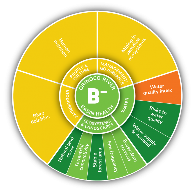
Overall the Orinoco River basin received a B- (63%). Results varied widely, with generally better results for indicators within Ecosystems & Landscapes and Water categories, than indicators from the Biodiversity, People & Culture and Management & Governance categories. However, it is important to note that the poorer scoring categories also had the fewest indicators due to limited data availability. Overall basin scores ranged from as low as 39% for Water Quality, to as high as 93% for Stable Forest Area (representing intact forests between 1990-2014 in the Amazon-Orinoco transition zone).
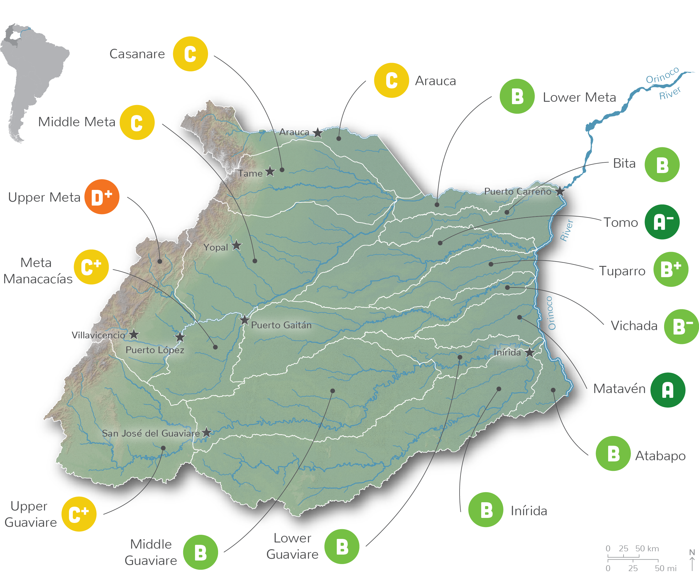
At the sub-basin scale, results showed a strong west-east gradient where the Upper Meta had the poorest grade, D+ (37%), and Matavén had the highest grade, A (87%). The differences between western and eastern portions of the Orinoco River Basin are due to development pressure in the west, resulting in poorer water quality, and significant changes to the landscape.
Notable changes in Andean sub-basins in the west include elevated rates of deforestation in the Upper Guaviare, associated with poor water quality; a lack of terrestrial connectivity in the Upper Meta; major changes in the fire regime in the Meta Manacacías; low water quality and mining for construction materials in Casanare, as well as low human nutrition in the Arauca basin. Furthermore, these sub-basins have undergone significant agro-industrial expansion, oil and gas exploitation, urbanization, and intensive livestock activities.
The Llanos and Amazon transition sub-basins to the south and east were not immune to poor scores with the Inírida sub-basin receiving the poorest score (31%) for human nutrition (based on the weight of 0-4 year-old children), and the Vichada scoring poorly (25%) for mining of construction materials for new infrastructure, mainly related to the oil boom in the region.
