EcoHealth Report Cards
  • About
  • The Process
  • Contact
  • Report Cards
    • Chesapeake Bay
    • Clinton River
    • Detroit River
    • Guanabara Bay
    • Huron River
    • Lake Erie
    • Long Island Sound
    • Maryland Coastal Bays
    • Orinoco River
    • Rio Grande
    • River Raisin
    • Rouge River
    • Southeast Michigan
    • Sudbury, Assabet, & Concord Rivers
    • Verde River
    • Willamette River

Chesapeake Bay

  • Home
  • Bay Health
  • Watershed Health
  • Indicators
    • Overall Health Index
    • Dissolved Oxygen
    • Nitrogen
    • Phosphorus
    • Turbidity
    • Water Quality Index
    • Chlorophyll a
    • Water Clarity
    • Aquatic Grasses
    • Benthic Community
    • Blue Crab
    • Bay Anchovy
    • Striped Bass
    • Protected Lands
    • Stewardship
    • Social Index
    • Walkability
    • Heat Vulnerability Index
    • Fish community
    • Median income
    • Housing affordability
    • Income inequality
    • Jobs growth
    • Environmental Justice Index
  • Bay Regions
    • Lower Eastern Shore
    • Choptank River
    • Upper Eastern Shore
    • Upper Western Shore
    • Patapsco and Back Rivers
    • Lower Western Shore
    • Patuxent River
    • Potomac River
    • Rappahannock River
    • York River
    • James River
    • Elizabeth River
  • Watershed Regions
    • Overall
    • Chemung
    • Choptank
    • Elizabeth
    • Juniata
    • Lower Eastern Shore
    • Lower James
    • Lower Potomac
    • Lower Susquehanna
    • Lower Western Shore
    • Middle James
    • Middle Potomac
    • Middle Susquehanna
    • Patapsco and Back
    • Patuxent
    • Rappahannock
    • Shenandoah
    • Upper Eastern Shore
    • Upper James
    • Upper Potomac
    • Upper Susquehanna
    • Upper Western Shore
    • West Branch Susquehanna
    • York
  • Issues
    • 2023
    • 2022
    • 2021
    • 2020
    • 2019
    • 2018
    • 2017
    • 2016
    • 2015
    • 2014
    • 2013
    • 2012
    • 2011
    • 2010
    • 2009
    • 2008
    • 2007
    • 2006
  • Publications
  • Take Action
  • About
  1. Home
  2. Report Cards
  3. Chesapeake Bay
  4. Indicators
  5. Stewardship

Stewardship

Tree planting supports the Bay and local communities. Photo by Will Parson, Chesapeake Bay Program.

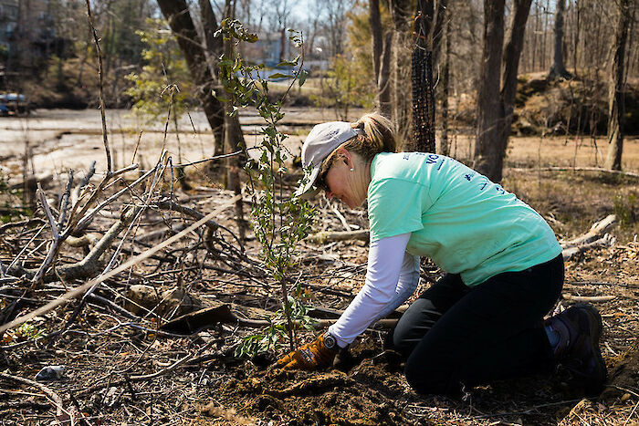
Approximately 18 million people live in the Chesapeake Bay Watershed and more are moving in each year. Every day, those 18 million people make decisions that affect the Bay’s health. Without the active participation of these residents, our restoration efforts will be unsuccessful. Individual stewardship is vitally important to the health of local watersheds and the Bay as a whole.

So, how active and engaged are the residents of the Bay watershed? The Stewardship Index was created in 2017 to measure just that. It is the first comprehensive survey of residential stewardship actions and attitudes in the Chesapeake Bay watershed, and one of the first like it in the country. The data presents a powerful resource for agencies and organizations working to foster stewardship, whether it is informing programs that seek to increase the adoption of individual actions, spurring volunteerism and collective action, or cultivating leaders who mobilize others.

Generated from a random probability sample of 5,212 Chesapeake Bay watershed residents, conducted by telephone, the survey measured the following: 19 individual stewardship behaviors and the likelihood of those surveyed to perform those behaviors in the future, levels of volunteerism and civic engagement, and attitudes that impact personal stewardship. The stewardship index will be conducted again in 2022 to measure progress. Meanwhile, the data from the first survey has been used to create a baseline and tools for use in advancing stewardship throughout the watershed.

While you can access the raw data and more background about the Stewardship Indicator on Chesapeake Progress, you will soon be able to explore and manipulate the data through an interactive website, available through the Chesapeake Progress site. This website will allow users to filter the data to identify the best opportunities for behavior adoption, and will provide resources to create an effective behavior change campaign. This website will be available by fall 2021.

How is it measured?

The Stewardship Index developed by the Chesapeake Bay Program's Stewardship Workgroup and OpinionWorks was tailored to the Chesapeake Bay Watershed Report Card reporting regions. The data is from 2017.

Threshold levels

The survey responses were scored based on whether actions people take positively or negatively impact the Bay environment.

In this section

  • Indicators
    • Overall Health Index
    • Dissolved Oxygen
    • Nitrogen
    • Phosphorus
    • Turbidity
    • Water Quality Index
    • Chlorophyll a
    • Water Clarity
    • Aquatic Grasses
    • Benthic Community
    • Blue Crab
    • Bay Anchovy
    • Striped Bass
    • Protected Lands
    • Stewardship
    • Social Index
    • Walkability
    • Heat Vulnerability Index
    • Fish community
    • Median income
    • Housing affordability
    • Income inequality
    • Jobs growth
    • Environmental Justice Index

© 2025 UMCES

  • Home
  • About
  • The Process
  • Contact
  • Report Cards
    • Chesapeake Bay
      • Bay Health
      • Watershed Health
      • Indicators
        • Overall Health Index
        • Dissolved Oxygen
        • Nitrogen
        • Phosphorus
        • Turbidity
        • Water Quality Index
        • Chlorophyll a
        • Water Clarity
        • Aquatic Grasses
        • Benthic Community
        • Blue Crab
        • Bay Anchovy
        • Striped Bass
        • Protected Lands
        • Stewardship
        • Social Index
        • Walkability
        • Heat Vulnerability Index
        • Fish community
        • Median income
        • Housing affordability
        • Income inequality
        • Jobs growth
        • Environmental Justice Index
      • Bay Regions
        • Lower Eastern Shore
        • Choptank River
        • Upper Eastern Shore
        • Upper Western Shore
        • Patapsco and Back Rivers
        • Lower Western Shore
        • Patuxent River
        • Potomac River
        • Rappahannock River
        • York River
        • James River
        • Elizabeth River
      • Watershed Regions
        • Overall
        • Chemung
        • Choptank
        • Elizabeth
        • Juniata
        • Lower Eastern Shore
        • Lower James
        • Lower Potomac
        • Lower Susquehanna
        • Lower Western Shore
        • Middle James
        • Middle Potomac
        • Middle Susquehanna
        • Patapsco and Back
        • Patuxent
        • Rappahannock
        • Shenandoah
        • Upper Eastern Shore
        • Upper James
        • Upper Potomac
        • Upper Susquehanna
        • Upper Western Shore
        • West Branch Susquehanna
        • York
      • Issues
        • 2023
        • 2022
        • 2021
        • 2020
        • 2019
        • 2018
        • 2017
        • 2016
        • 2015
        • 2014
        • 2013
        • 2012
        • 2011
        • 2010
        • 2009
        • 2008
        • 2007
        • 2006
      • Publications
      • Take Action
      • About
    • Clinton River
      • Health
      • Indicators
        • Overall Health Index
        • Household Income
        • Local Ownership
        • Cost of Flooding
        • Income Equality
        • Trade
        • River Economy
        • Wetlands
        • Tree Cover
        • Forests
        • Fish Populations
        • Bird Diversity
        • Benthic Community
        • Protected Lands
        • Fish Consumption
        • Bacteria
        • Heat Vulnerability
        • Air Quality Index
        • Environmental Justice
        • Flooding
        • Sewer Overflows
        • Impervious Surfaces
        • Farmland
        • Affordable Housing
        • Walkability
        • Parks
        • Beach Access
        • Watercraft Access
        • Fishing
        • Nitrogen
        • Phosphorus
        • Dissolved Oxygen
        • Water Temperature
        • Turbidity
      • Region
        • Clinton River
      • Issues
      • Publications
      • About
    • Detroit River
      • Health
      • Indicators
        • Overall Health Index
        • Household Income
        • Local Ownership
        • Cost of Flooding
        • Income Equality
        • Trade
        • River Economy
        • Wetlands
        • Tree Cover
        • Forests
        • Fish Populations
        • Bird Diversity
        • Benthic Community
        • Protected Lands
        • Fish Consumption
        • Bacteria
        • Heat Vulnerability
        • Air Quality Index
        • Environmental Justice
        • Flooding
        • Sewer Overflows
        • Impervious Surfaces
        • Farmland
        • Affordable Housing
        • Walkability
        • Parks
        • Beach Access
        • Watercraft Access
        • Fishing
        • Nitrogen
        • Phosphorus
        • Dissolved Oxygen
        • Water Temperature
        • Turbidity
      • Region
        • Detroit River Watershed
      • Issues
      • Publications
      • About
    • Guanabara Bay
      • Bay Health
      • Basin Health
      • Indicators
        • Overall Health Index
        • Dissolved Oxygen
        • Biological Oxygen Demand
        • Dissolved Inorganic Nitrogen
        • Total Phosphorus
        • Orthophosphate
        • Turbidity
        • Fecal coliform
      • Sanitation
      • Issues
      • Publications
      • About
    • Huron River
      • Health
      • Indicators
        • Overall Health Index
        • Household Income
        • Local Ownership
        • Cost of Flooding
        • Income Equality
        • Trade
        • River Economy
        • Wetlands
        • Tree Cover
        • Forests
        • Fish Populations
        • Bird Diversity
        • Benthic Community
        • Protected Lands
        • Fish Consumption
        • Bacteria
        • Heat Vulnerability
        • Air Quality Index
        • Environmental Justice
        • Flooding
        • Sewer Overflows
        • Impervious Surfaces
        • Farmland
        • Affordable Housing
        • Walkability
        • Parks
        • Beach Access
        • Watercraft Access
        • Fishing
        • Nitrogen
        • Phosphorus
        • Dissolved Oxygen
        • Water Temperature
        • Turbidity
      • Region
        • Huron River
      • Issues
      • Publications
      • About
    • Lake Erie
      • Lake Health
      • Watershed Health
      • Indicators
        • Overall Health Index
        • Total Phosphorus
        • Dissolved Phosphorus
        • Total Nitrogen
        • Nitrate + Nitrite
        • Chlorophyll a
        • Walleye
        • Yellow Perch
        • Emerald Shiner
        • Bloom Index
        • Source Water Toxin
        • Recreational Toxin
        • Total Suspended Solids
        • Fish
        • Macroinvertebrates
        • Habitat Quality
        • Fish Consumption
        • Pesticide
      • Lake Regions
        • Overall Lake
        • Northwest
        • Southwest
        • Maumee
        • Northeast
        • Eastern Islands
        • Sandusky Bay
      • Watershed Regions
        • Overall Watershed
        • Auglaize
        • Cedar/Portage
        • Detroit
        • Essex
        • Raisin/Huron
        • St. Joseph
        • St. Marys
        • Lower Maumee
        • Lower Thames
        • Sandusky
        • Tiffin
        • Upper Maumee
        • Upper Thames
      • Issues
      • Publications
      • Take Action
      • About
    • Long Island Sound
      • Health
      • Indicators
        • Overall Health Index
        • Dissolved Oxygen
        • Chlorophyll a
        • Water Clarity
        • Dissolved Organic Carbon
      • Regions
        • Overall
        • Western Narrows
        • Eastern Narrows
        • Western Basin
        • Central Basin
        • Eastern Basin
      • Issues
        • 2018
        • 2015
        • 2013
      • Publications
      • Take Action
      • About
    • Maryland Coastal Bays
      • Health
      • Indicators
        • Overall Health Index
        • Chlorophyll a
        • Dissolved Oxygen
        • Nitrogen
        • Phosphorus
        • Seagrass
        • Hard Clams
      • Regions
        • Overall
        • Assawoman Bay
        • Chincoteague Bay
        • Isle of Wight Bay
        • Newport Bay
        • Sinepuxent Bay
        • St. Martin River
      • Issues
        • 2023
        • 2022
        • 2021
        • 2019
        • 2018
        • 2017
        • 2016
        • 2015
      • Publications
      • Take Action
      • About
    • Orinoco River
      • Health
      • Indicators
        • Water Quality Index
        • Risks to Water Quality
        • Water Supply and Demand
        • Natural Land Cover
        • Stable Forest Area
        • Terrestrial Connectivity
        • Fire Frequency
        • Ecosystem Services
        • Human Nutrition
        • Mining in Sensitive Ecosystems
        • River Dolphins
      • Regions
        • Arauca River
        • Atabapo River
        • Bita River
        • Guaviare River
        • Inírida River
        • Matavén River
        • Meta River
        • Tomo River
        • Tuparro River
        • Vichada River
      • Issues
      • Publications
      • About
    • Rio Grande
      • Health
      • Indicators
        • Overall Health Index
        • Annual low flow
        • Zero Flow Days
        • Municipal Water Supply
        • Groundwater
        • Agriculture surface water supply
        • Flow Alteration
        • Riparian Areas
        • Water Supply for Compact
        • Impaired Streams
        • Invasive Trees and Shrubs
        • Wetland Loss
        • Bird Diversity
        • Silvery Minnow
        • Native Fish Diversity
        • All Fish Diversity
        • Native peoples and acequias support
        • Native peoples and acequias representation
        • Water Resource Governance
        • Water Resource Management
        • Protected Lands
        • Fire
        • Park Visitation
        • Recreation Access
        • Cultural and Historical Places
        • Walkability
        • Heat Vulnerability Index
        • Social Vulnerability Index
        • Air Quality
        • Affordable Housing
      • Regions
        • Overall
        • Upper Rio Grande - CO
        • Upper Rio Grande - NM
        • Middle Rio Grande
        • Lower Rio Grande
      • Issues
      • Publications
      • About
    • River Raisin
      • Health
      • Indicators
        • Overall Health Index
        • Household Income
        • Local Ownership
        • Cost of Flooding
        • Income Equality
        • Trade
        • River Economy
        • Wetlands
        • Tree Cover
        • Forests
        • Fish Populations
        • Bird Diversity
        • Benthic Community
        • Protected Lands
        • Fish Consumption
        • Bacteria
        • Heat Vulnerability
        • Air Quality Index
        • Environmental Justice
        • Flooding
        • Sewer Overflows
        • Impervious Surfaces
        • Farmland
        • Affordable Housing
        • Walkability
        • Parks
        • Beach Access
        • Watercraft Access
        • Fishing
        • Nitrogen
        • Phosphorus
        • Dissolved Oxygen
        • Water Temperature
        • Turbidity
      • Region
        • River Raisin
      • Issues
      • Publications
      • About
    • Rouge River
      • Health
      • Indicators
        • Overall Health Index
        • Household Income
        • Local Ownership
        • Cost of Flooding
        • Income Equality
        • Trade
        • River Economy
        • Wetlands
        • Tree Cover
        • Forests
        • Fish Populations
        • Bird Diversity
        • Benthic Community
        • Protected Lands
        • Fish Consumption
        • Bacteria
        • Heat Vulnerability
        • Air Quality Index
        • Environmental Justice
        • Flooding
        • Sewer Overflows
        • Impervious Surfaces
        • Farmland
        • Affordable Housing
        • Walkability
        • Parks
        • Beach Access
        • Watercraft Access
        • Fishing
        • Nitrogen
        • Phosphorus
        • Dissolved Oxygen
        • Water Temperature
        • Turbidity
      • Region
        • Rouge River
      • Issues
      • Publications
      • About
    • Southeast Michigan
      • Health
      • Indicators
        • Overall Health Index
        • Household Income
        • Local Ownership
        • Cost of Flooding
        • Income Equality
        • Trade
        • River Economy
        • Wetlands
        • Tree Cover
        • Forests
        • Fish Populations
        • Bird Diversity
        • Benthic Community
        • Protected Lands
        • Fish Consumption
        • Bacteria
        • Heat Vulnerability
        • Air Quality Index
        • Environmental Justice
        • Flooding
        • Sewer Overflows
        • Impervious Surfaces
        • Farmland
        • Affordable Housing
        • Walkability
        • Parks
        • Beach Access
        • Watercraft Access
        • Fishing
        • Nitrogen
        • Phosphorus
        • Dissolved Oxygen
        • Water Temperature
        • Turbidity
      • Regions
        • Overall
        • Clinton
        • Detroit
        • Huron
        • Raisin
        • Rouge
      • Issues
      • Publications
      • About
    • Sudbury, Assabet, & Concord Rivers
      • Health
      • Indicators
        • Overall
        • Dissolved Oxygen
        • Temperature
        • Suspended Solids
        • Phosphorus
        • Nitrogen
        • Floating Biomass
        • Streamflow Alteration
        • Groundwater Level
        • Summer Streamflow
        • Visual Quality
        • Cultural Importance
        • Impervious Cover
        • Aquatic Connectivity
        • Ecological Integrity
        • Passability
        • Access
        • Trails
        • Bacteria
        • Fish Edibility
      • Regions
        • Upper Sudbury River
        • Lower Sudbury River
        • Upper Assabet River
        • Lower Assabet River
        • Upper Concord River
        • Lower Concord River
      • Issues
      • Publications
      • Take Action
        • Discover your rivers
        • Roll up your sleeves
        • Become a citizen scientist or advocate
        • Celebrate success
      • About
    • Verde River
      • Health
      • Indicators
        • Overall Health Index
        • Base Flow
        • Surfacewater BMPs
        • Groundwater BMPs
        • Water Quality Index
        • Water Quality Certainty
        • Turbidity
        • Macroinvertebrates
        • Upland Condition Index
        • Riparian Birds
        • Fish
        • Recreation Planning
        • Visitor Satisfaction
        • Recreation Access
        • Civic Engagement
        • Digital Engagement
        • Healthcare
        • Education
        • Unemployment
        • Affordable Housing
      • Regions
        • Overall
        • Big and Little Chino
        • Upper Verde
        • Upper Verde Valley
        • Oak Creek
        • Lower Verde Valley
        • Wild and Scenic
        • Lower Verde
      • Issues
      • Publications
      • Take Action
      • About
    • Willamette River
      • Health
      • Indicators
        • Overall Health Index
        • Water Quality Index
        • Toxics
        • Temperature
        • Native Fish
        • Non-native Fish
        • Juvenile Chinook
        • Bald Eagle
        • Channel Complexity
        • Floodplain Forest
        • Flow Targets
        • Peak Flows
        • Fish Consumption Advisories
        • Tribal Fisheries
        • Fecal Bacteria
        • Harmful Algal Blooms
      • Regions
        • Upper Willamette
        • Middle Willamette
        • Lower Willamette
      • Issues
      • Publications
      • Take Action
        • Know your river
        • Make a change
        • Join the movement
        • Celebrate success
      • About