Monitoring and assessment challenges

Over the past 20 years, a great deal has been done to determine the health and status of the Coastal Bays. Information to assess the health of the bays is obtained from multiple partners including local governments, volunteers, academic institutions, and state and federal agencies. Data is assessed in collaboration through the Maryland Coastal Bays Program. Continuation of long term monitoring is vital since nutrient loads are heavily influenced by groundwater inputs which take years to reach the bays.
The coastal bays monitoring plan evaluates achievement of water quality goals (seagrass and chlorophyll), as well as if the bays are meeting the ‘bay diet’ or total maximum daily load endpoints (for oxygen and chlorophyll). Data are also integrated and presented to managers and the public through State of the Bay reports and annual report cards.
Key indicators are used to inform managers on the progress of actions taken to protect the Maryland Coastal Bays and inform citizens about the health of the bays. Although various factors affect the sustainability of environmental monitoring programs, funding levels influence many aspects of program continuity. Partnerships and leveraging of funding from other sources have helped maintain some monitoring components but there is a need for sustained and dedicated funding for core indicators and even increased funding to implement innovative monitoring programs.
Discover Your Watershed

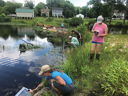
Discover Your Watershed is a public engagement series that encourages residents to explore MCBP’s restoration and management properties. Five education and service days were offered at sites around the Coastal Bays. Ninety participants planted native trees, removed invasive plants, reconstructed a trail, and learned orienteering, macroinvertebrate sampling, and tree survey techniques.
Lizard Hill wetland restoration

Lizard Hill is a 20-acre sand seepage wetland restoration site built near Bishopville, Maryland in 2011. Water quality monitoring at the site, which flows into the St. Martin River, indicates that the wetland provides nitrogen storage and removal and that the amount of nitrogen retained has increased over the past seven years. In 2017, the wetland removed over one-half ton of nitrogen.
