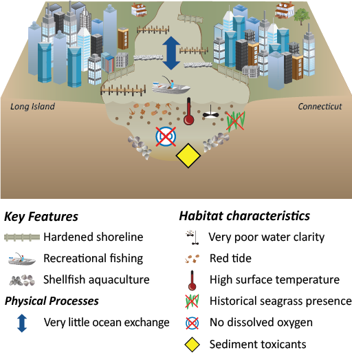
The Western Narrows is shallow, has a high tidal range, but the flushing is fairly inefficient between the East River and the rest of Long Island Sound. It has a muddy bottom and the sediments are highly contaminated from historical industrial activities. There are chronic dissolved oxygen problems in the bottom waters of the Western Narrows. The water is very turbid, which prevents phytoplankton growth. The Western Narrows is densely urban. The watershed draining into the Western Narrows is almost entirely New York City. There is a significant input of treated wastewater and urban stormwater to this area. It is intensely populated and primarily has hardened shorelines.
This reporting region is between the East River opening into Long Island Sound at the western-most boundary of the Sound (near the RFK/Triborough Bridge) and the eastern boundary denoted as an east-west line between Sands Point (between Manhasset Bay and Hempstead Harbor) on Long Island to the northern end of Pelham Bay Park on the mainland side of the Sound. The Western Narrows includes the infamous Hell Gate, three major bridges (Triborough/RFK, Whitestone, Throgs Neck), three major islands (Rikers, City, Hart).

