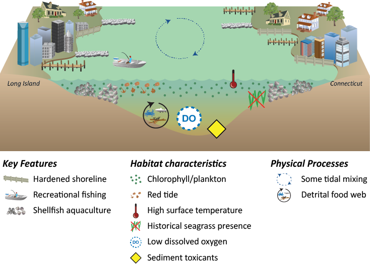
Western Long Island Sound is slightly deeper than the Narrows, with a channel, and the tidal range is reduced. It has a muddy bottom and sediments are moderately contaminated. It has sporadic hypoxic bottom waters. The water is clearer in Western Long Island Sound. The land use surrounding this area is continuously suburban, but the development is less dense. There is a significant input of treated wastewater to this area. Western Long Island Sound has a relatively large embayment, Smithtown Bay, which is characterized by reduced circulation, and lower water quality. The watershed draining into Western Long Island Sound includes Long Island and a relatively small portion of Connecticut.
This reporting region extends from the Eastern Narrows to a line extending from Old Field Point between Stony Brook and Port Jefferson Harbors on Long Island to Stratford Point between Black Rock and Bridgeport Harbors on the Connecticut shore. This boundary is very near the route of the Bridgeport-Port Jefferson ferry. Western Long Island Sound forms the northern boundaries of Setauket Harbor, Flax Pond and Stony Brook Harbor on Long Island and the southern boundaries of Norwalk Harbor, Saugatauk River, Sherwood Millpond, Southport Harbor and Black Rock Harbor on the Connecticut shoreline. There is a clockwise residual water circulation in this region.

