The Sandusky River drains directly into Sandusky Bay, which is a uniquely shallow and enclosed bay of the western Lake Erie basin. The Sandusky River system drains 1828 mi2/4,734 km2 of 12 counties in northwestern Ohio. The predominant land use in the watershed is agriculture, both cultivated crop and pasture lands, with some areas of urban development. The mouth of the river has some wetlands. The Sandusky watershed is home to 220,000 people.*
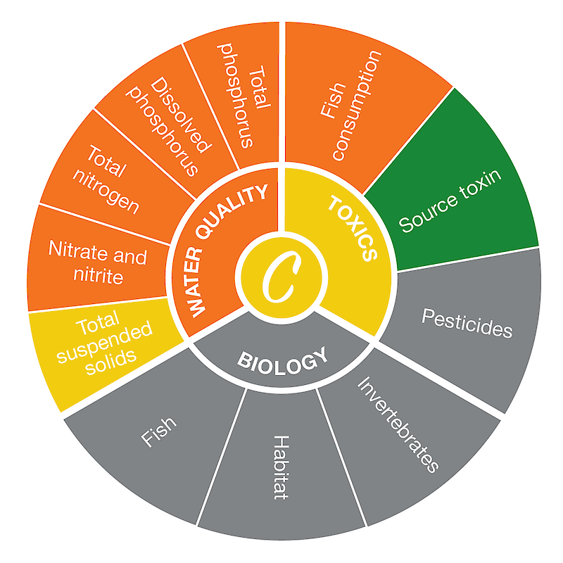
The Sandusky region score was based on seven indicators with sufficient data. The highest-scoring indicator was source water toxin, while the lowest-scoring indicator was dissolve phosphorus. Read more about the individual indicators here.
*Information from the Ohio Environmental Protection Agency.

